Nepal Himalaya
Containing nine of the world's fourteen highest mountain peaks, Nepal is a true Himalayan kingdom. The Himalaya cover three fourths of the land in Nepal. It is home to some of the highest, remotest, most rugged and most difficult terrain in the world. The loftiest peak in the world -- Mount Everest -- and other high peaks like Lhotse, Nuptse, Annapurna, Dhaulagiri and Manaslu, plus the presence of some exquisitely beautiful trekking routes, attract hundreds of thousands of people from all over the world to this lovely Himalayan destination
The country of Nepal can be divided into three parallel bands running from the northeast towards the southwest. Along the north of Nepal runs the Great Himalayan Range, the highest mountain range in the Himalayan system. This range has an average altitude of about 4,570 m (about 15,000 ft) and remains perpetually snow-covered. On this range rise some of the loftiest mountain peaks in the world -- Mount Everest, Kanchenjunga, Lhotse, Makalu, Cho Oyu, Dhaulagiri, Manaslu, and Annapurna.
Further south runs a complex system of intermediate ranges at an altitude of 8,000-14,000 ft. Prominent ranges in this mountain system include the Mahabharat and Churia ranges. High mountain ranges are interspersed with broad inhabited river valleys. The third and southernmost region is the Terai, a swampy terrain which is the northern extension of the Indian plains.
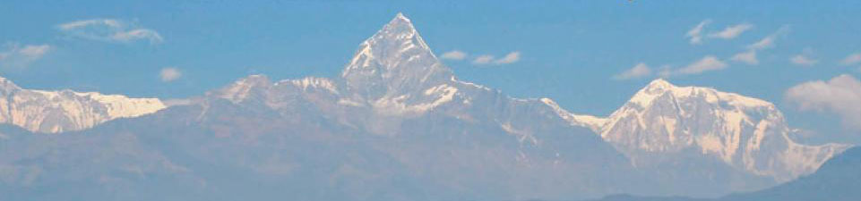
Panoramic view of the Himalayan range
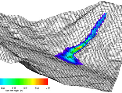
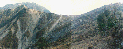
Occurrence of landslides in the Lesser Himalaya, central Nepal
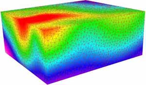
Remote Sensing, GIS, Visualisation
Remote Sensing: is the
science and art of acquiring information (spectral, spatial and temporal) about
material objects, area, or phenomenon, without coming into physical contact
with the objects, or area, or phenomenon under investigation (Lillesand & Kiefer 1987).
GIS: is defined as a powerful set of tools
for collecting, storing, retrieving at will, displaying, and transforming
spatial data, and their attributes (Burrough & McDonnel 1998).
Visualisation:
is the cutting edge of new way of thinking about science but its styles
vary enormously with context which is so broad a term that to define its role
in spatial modelling. The visualisation explore unanticipated outcomes and to
refine processes that interact in unanticipated ways; and visualisation is to
enable end users with no prior understanding of the science but a deep
understating of the problem to engage in using models for prediction (Batty et al. 2004).


Selected Publications:
3D visualisation of geological objects, Bull. Nepal Geol. Soc, v. 31, pp. 45–48 (2014).
Practical Engineering Geology. ST Publisher, Kathmandu, Nepal 142p. (2013).
Landslide susceptibility modelling in the central Nepal Lesser Himalaya. Jour. of German Soc. Geosci., 162(4): 405–420, Stuttgart (2011).
GIS-based Quantitative landslide hazard prediction modelling in natural hillslope, Agra Khola watershed, central Nepal. Bull. Dept. Geol., Tribhuvan University, Kathmandu, Nepal, v 10, pp. 63-70 (2007).
GIS-based modelling of landslide and debris flow hazard modelling in the mountainous terrain of Agra Khola Watershed, central Nepal. Proceedings of the Fifth Asian Regional Conference on Engineering Geology for Major Infrastructure Development and Natural Hazard Mitigation, Nepal Geol. Soc., v 34, pp. 117-128 (2006).
Landslide and Debris flow Characteristics and Hazard Mapping in Mountain Hill-slope Terrain by Using GIS, Central Nepal. In: Landslide Risk Management, Taylor and Francis, pp. 657-668 (2005).
Stratigraphy and structure of the inner Lesser Himalaya between Kusma and Syangja, Western Nepal, Jour. of Nepal Geol. Soc., v 27 (Sp. Issue), pp. 25-37 (2002).
Application of Geology, Geomorphology, and Hydrology in Landslide Hazard Mapping: Examples from Western Nepal Himalaya, Bull. Dept., Tribhuvan University, Kathmandu, Nepal, v 6, pp. 71-87 (1998).
Alford, D. (1992):
Hydrological Aspects of the Himalayan Region ICIMOD Occasional paper no. 18,
pp.68, Kathmandu.
Batty, M., Steadman,
P. & Xie, Y. (2004): Visualization in Spatial Modeling. ESLab International Workshop on the Study of Artificial Complex Environments,
San Servolo, Venice, Italy.
Burrough, P. A & McDonnell, R. (1998): Principles of geographical
information systems. Oxford University Press, London.
Gansser, A. (1964):
Geology of the Himalaya. London/New York/Sydney: Wiley Interscience. 289 p.
Hagen, T. (1969):
Preliminary Reconnaissance. Report on the Geological Survey of Nepal. 86.
Denkschriften der Schweizerischen Naturforschenden Gesellschaft. v. 1:
pp. 185.
Heim, A. & Gansser, A. (1939): Central Himalaya Geological Observations of Swiss Expedition, 1936. p. 246.
Le Fort, P. (1996): "Evolution of the Himalaya". In Yin, A. and Harrison, T. M. Tectonic Evolution of Asia. New York: Cambridge University Press. pp. 95–109.
Lillesand, T. M. & Kiefer, R. W. 1987: Remote Sensing
and Image Interpretation. 2nd Ed. Wiley, New York.
For Prospective Students
Interested in Masters or Ph.D. degree under my guidance, contact me to discuss research interests. Individuals must have a bachelors- or masters-level degree in geosciences or the engineering with background in GIS, remote sensing, geostatistics, pattern-recognition and programming languages.